Suncurves and sun conditions support
Welcome to our support pages! Please get in touch on Facebook or at support@suncurves.com, but if you have any specific questions, they may already have been answered in the FAQ section below.
Frequently Asked Questions (FAQ)
What is the sun index?
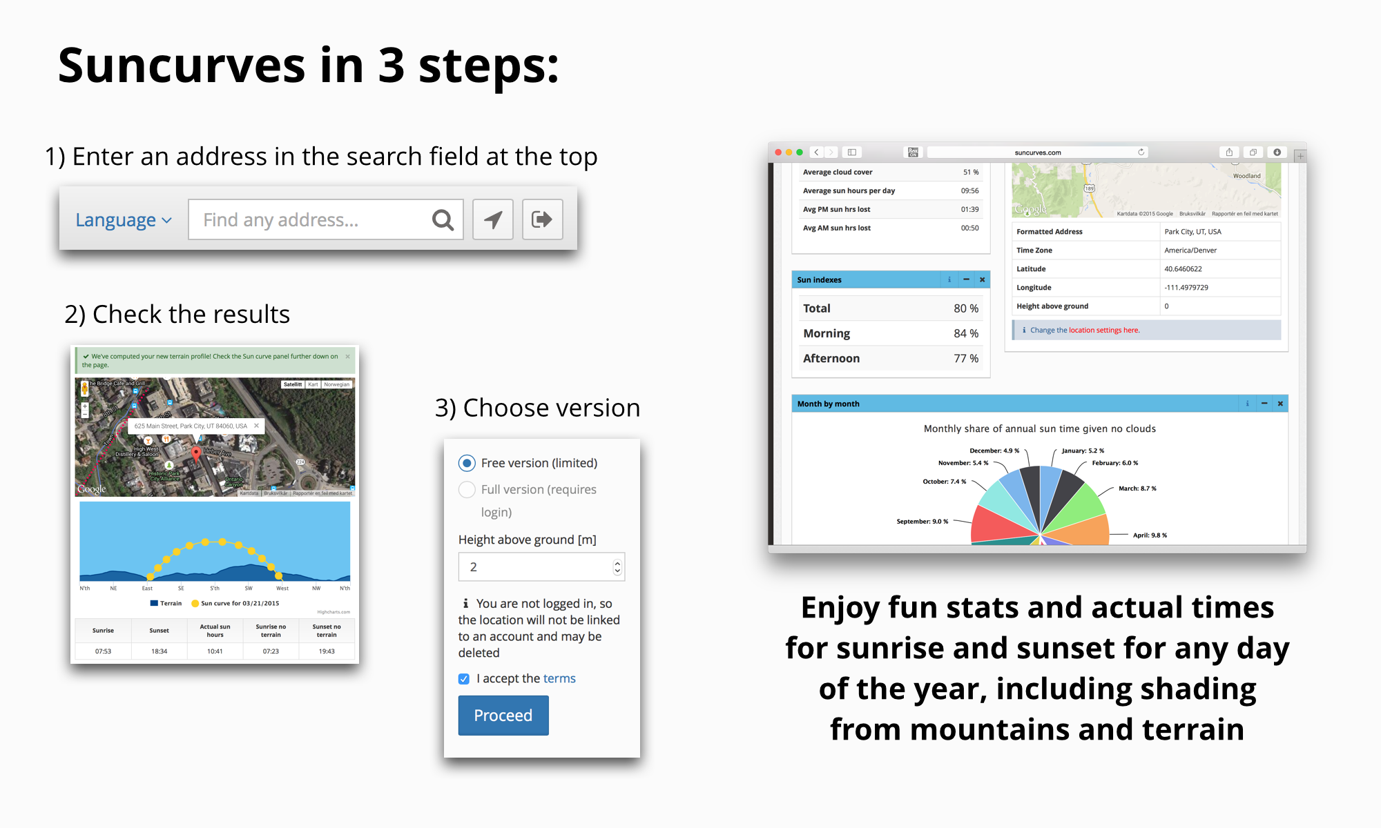
For each property, we compute a total sun index. This is simply the percentage of the sun uptime with respect to what the total sun uptime would have been if there was no topography involved. If you look up the sunrise and sunset in the newspaper or on a web site, you'll get the times for an imaginary planet with no mountains. For instance, on the day that I wrote this, 2 October 2013, the official sunrise time at our office in Bergen was 7.47 (see timeanddate.com). But in reality, because the mountain to the east of us blocks the morning sun, the sun came up at 8.54, spot on according to our computations. So we "lost" one hour and seven minutes this morning. The total number of sun hours on 2 October, again according to the timeanddate web site, was 11 hours and 21 minutes. The "official" sunset today was at 19.08, but according to our calendar the sun set at 18.27. That's another 41 minutes lost. All right. To compute the sun index for that day, we have to compute how many hours we actually had sunlight. That would be 9 hours 34 minutes (or 9.57 in decimal form) according to our calendar, and 11 hours 21 minutes (11.35) according to the timeanddate web site. The ratio 9.57 / 11.35 is 0.84, which means that the sun index for 2 October 2013 is 84%. The sun index can be computed for individual days, but also for periods, such as for each month or for the whole year. We also do separate ones for morning and evening (before and after noon).How do you compute the terrain profile?
We base our computations on the global topography data. In short, scientists have used satellite images to derive the height of pretty much every location in the world. This data was saved as point data in a global grid. So when you select a point or give us your exact coordinates, we can find that location in the data and base our calculations on the nearby grid points. The simple explanation of how we do this is as follows: First we find the nearest grid point to your location. Then we have to find the highest point that you can see from your location in every direction. To do that, we compute the angle between your line of sight and any hill or mountain before you. That is the angle that we show in all our figures. Having done that for each direction of the compass, we get a complete terrain profile, which we can use to compute the sunrise and sunset for every day of the year. Note that some uncomfortable issues may arise if there is a tall feature very close to your location. It's not always clear how that should be handled, but we have tried to find a compromise that works well in most cases. But our way of computing the terrain profile might be invalid in some extreme cases. There could also be something wrong with the topography data. But as long as what you see on the web page looks reasonable, our reports will yield reasonable information on the sun conditions.What is the accuracy of the sunrise and sunset times in the calendar?
The listing of exact sunrise and sunset times in the calendar is perhaps a bit misleading. There are many factors that influence the exact timing of these events, and most of them are beyond our control. Here are the most dominant factors:- The data that we use to compute the terrain profile could be faulty in some locations and therefore lead to errors.
- If you are located very close to a distinct terrain feature, such as a mountain or a hill, the angle between yourlocation and that feature becomes large. This means that even small errors in the terrain data can lead to large errors in the terrain computations.
- The air temperature influences the way the sun beams move through the atmosphere. We have taken this into account, but we've had to use a fixed temperature of 20 degrees Celsius in all our calculations. This is obviously not correct in winter, and this may lead to small errors.

Suncurves AS (org.nr. 920 349 994) © 2024
support@suncurves.com
Built with Django, Python, Bootstrap, and Highcharts.
